
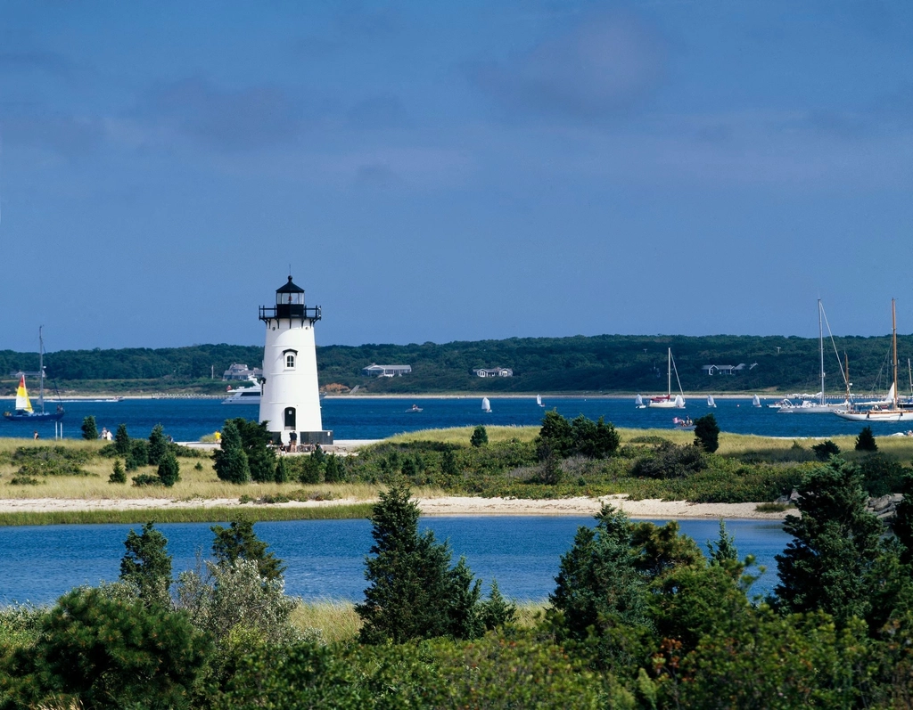
The Island’s salt marshes are iconic. But beyond being the muse for landscape painters and art photographers, they are an integral and productive ecosystem.
Salt marshes protect shorelines from storms and flooding, provide habitat to wildlife, and preserve water quality. They reduce the impacts of climate change by capturing large amounts of the carbon that is produced by fossil fuels. In fact, one acre of salt marsh stores 10 times more carbon than an acre of upland forest. And that means these marshes are even worth money. One study found that an acre of salt marsh is worth more than $10,000 a year through the benefits of stormwater reduction, fisheries, and water quality.
But local officials predict that the Island may lose up to 266 acres, about one-third the area of Central Park in New York City, of salt marsh by 2050 as a result of damage from historical agricultural practices and sea level rise. The marshes are not able to restore themselves as quickly when degraded, and the Island risks the loss of important shellfish and wildlife habitat — among other things — as a result.
The Trustees of Reservations, the state’s first and largest preservation and conservation nonprofit, is in the permitting stages of an extensive project to restore salt marsh habitat that extends from Poucha Pond behind Wasque Beach to Cape Poge. On Chappaquiddick alone, about 200 acres, or basically all the salt marsh within Cape Poge Bay and Poucha Pond, were identified by consultants contracted by the Trustees as vulnerable. The Trustees, which manages Wasque and Cape Poge Wildlife Reserve, received a grant from the National Fish and Wildlife Foundation for the project.

“We’re really not about resisting change, but more about working with ongoing coastal processes, so basically understanding what’s going on and directing change, rather than trying to work against change,” said Alejandra Narvaez, coastal project manager for the Trustees. Nature does “adapt on its own,” she said, but in this case, nature doesn’t have enough time to adapt to the impacts.
The goal of the project is to intervene, on a small and low-impact scale, while there’s still some healthy marsh left. The project, in the final design process, is a multi-agency effort; salt marshes on the Trustees’ parcels of land aren’t alone in their degradation. Other property owners, such as the Martha’s Vineyard Land Bank, Sheriff’s Meadow Foundation, and the Division of Marine Fisheries, are part of the effort. BiodiversityWorks and the Martha’s Vineyard Shellfish Group are also involved.
The project, aided by consultant teams at CZA GeoEnvironmental and Northeast Wetland Restoration, is twofold: Prevent the loss of barrier beaches and protect the salt marshes. The Trustees, averse to costly and oftentimes unsustainable beach nourishment or heavily engineered structures, opted to build up the resilience of the habitats behind the barrier beaches. Phase one of the project is in design now, and must go through local, state, and federal permitting processes, but optimistically, Narvaez estimates that work could be approved in a year.
Nature doesn’t make straight lines, Narvaez said, but the marshes hold history, and back in the 1600s and 1800s, farmers created ditches within the salt marsh, a European practice, to harvest high marsh hay. But when the ditches were abandoned, they started to decay.
Marshes need both water and sediment moving in and out to gain elevation and maintain resilience, but the decayed ditches clog the system, and have fractured the hydrology of the area. In a functioning system, the marsh grasses are flooded and drained by the tides, and so can accumulate sediment to form peat, a vessel of carbon capture that also provides the space and means for the marsh to build.

The consultants, who created a model to assess vulnerabilities in the barrier systems and salt marsh, recommended four resilience alternatives, to be implemented in phases: salt marsh restoration, marsh edge stabilization, breach interventions, and Dike Bridge improvements. Dike Bridge, which straddles Poucha Pond and the Narrows to Cape Poge Bay, is a long-term goal for the Trustees, because by 2070, they estimate the structure could see “topping almost on a daily basis with flooding,” Narvaez said, also impacting upstream movement of sediment to marshes on Poucha Pond.
“Our goals [are] to really identify those vulnerabilities, and see if there’s any interventions that we could do to protect the salt marsh, and then on the salt marsh itself, restore that hydrology so that we’re able to give the marsh a fighting chance for it to be able to keep pace with sea level rise by being able to accrete sediments more efficiently,” Narvaez said.
For the first phase of salt marsh restoration, the techniques to be used include ditch remediation and the creation of runnels, shallow channels that allow water to flow.
Ditch remediation is a speeding-up of the natural process. Stewards would mow salt-marsh hay adjacent to the ditches, and secure hay to the ditch with twine and stakes, building up the elevation faster, which would then naturally remediate and restore hydrology to a single channel. “We’re trying to use this existing structure, not really reinventing the wheel or having to have a really significant impact on the marsh, but recreating a more naturalized tidal network with the agricultural ditches,” Narvaez said.
There is significant standing water in the marshes, and so the Trustees hope to use runnels to connect the water back to an open channel or ditch, to allow vegetation to grow back. Other parts of the state have seen significant progress in just two years through the use of runnels. The excavated sediment of the manmade channels can then be piled into small mounds, called nesting islands, to revegetate other parts of the marsh.

The final technique, one the Trustees actually hope to pilot on Chappaquiddick, are phragmites control ditches. Phragmites are an invasive reed grass, and through the creation of deep runnels, the Trustees hope to bring saltwater into the area and control their spread.
Kristen Geagan, director of stewardship at Sheriff’s Meadow Foundation and part of the effort to restore the salt marsh, is hopeful and especially excited about the potential to reduce the phragmites population. The only success they’ve seen in phragmites reduction is through herbicides, but that’s not a technique they want to use or promote near saltwater estuaries.
Sakiko Isomichi, climate resilience planner for the Martha’s Vineyard Commission (MVC), isn’t aware of any other active salt marsh restoration projects on the Island, but research, done in partnership with the MVC, does indicate that the elevation of two salt marshes, in Aquinnah and Edgartown, won’t keep pace with projected sea level rise by 2100.
A new report, which hasn’t been officially published, by Laura Feher found that a salt marsh in Lobsterville is rising about 5.1 millimeters per year, and one at Felix Neck, off Sengekontacket Pond, is rising 3.7 millimeters per year. Both rates are above the approximately 3.1 millimeters annual sea level rise observed at Woods Hole over the past century, but less than the more recent rate reported of 5.7 millimeters per year, according to an MVC newsletter. Feher, who couldn’t be reached prior to publication, is a biologist and data manager for the National Parks Service, which has furloughed thousands of employees because of the Oct. 1 government shutdown that’s continued into November.
“With each visit, we see pockets of the salt marsh being overtaken by water,” Dan Doyle, MVC special projects planner and lead on the project, said in a September newsletter. “This is especially troubling given we visit at low tide as a rule.”
There is some hope for the salt marshes. Another study, published in 2022 by Robert S. Young and Katie Peek, discussed projected salt marsh migration on the fringes of Sengekontacket Pond. Through modeling digitized historical aerial imagery, Young and Peek estimated that 170 acres of dry land could transition to salt marsh over the next 30 years. And in most cases, movement wouldn’t be impeded by existing infrastructure, though some homeowners could see some of their land transitioned into marsh. This would actually suggest an increase in total marsh acreage, up from 160 acres at the time of their study.
The Trustees also project just under 100 acres of new marsh growth or migration that could occur in less developed areas in Edgartown, but didn’t find that new marsh would be equivalent to what is said to be lost.
“Our best bet for maintaining all of these benefits that salt marshes give us, not just us but also wildlife, is to maintain all the salt marshes we currently have,” Narvarez said. “That is the best bet.”
Please, we need solar on every roof.
Put solar on your own property, help others install solar, if you have the means.
And if you’re a politician, create legislation that pays for solar.
Let’s work together to save the salt marsh.